45.5883
14.4461
pohodniske-ture-nad-1200m
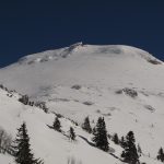
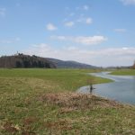
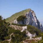
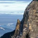
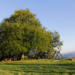
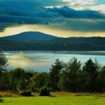
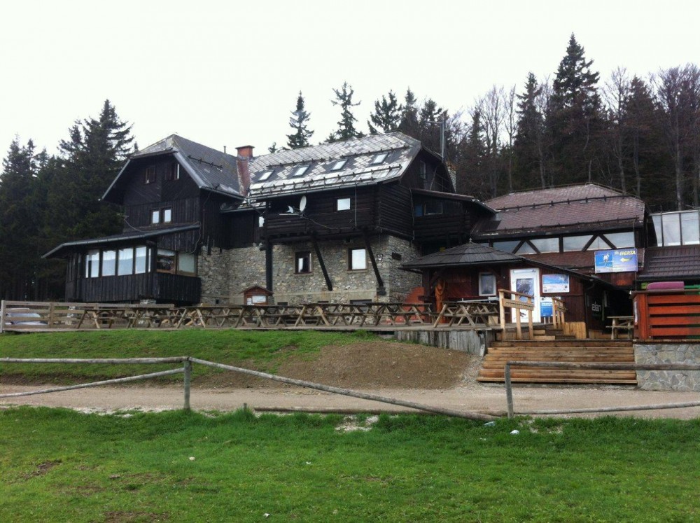
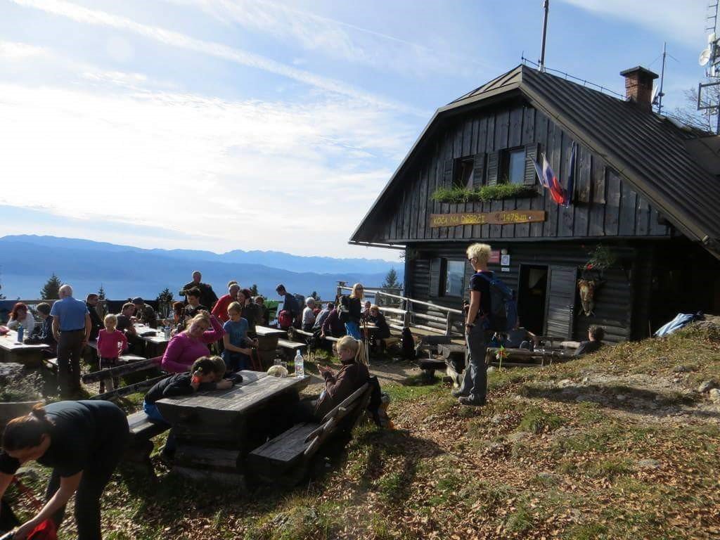
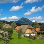
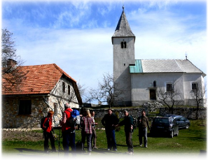
Snežnik (1,796 m) – Slovenia’s highest non-Alpine peak
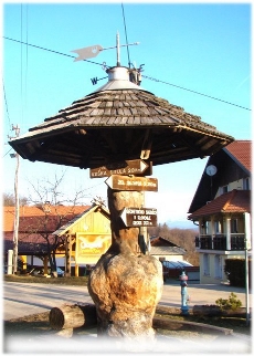
Slovenija, Notranjska, Loški Potok – Retje
marker-id-1
http://www.kamnaizlet.com/wp-content/themes/glocal/images/icons/pohodniske-tocke-green.png
Slovenija, Notranjska, Loški Potok – Retje
46.4006
16.1450
naravne-znamenitosti
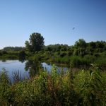
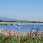
The Ormož Lagoons – a paradise for birdwatchers
Slovenija, Podravska, Ormoške lagune, Ormož
marker-id-2
https://www.kamnaizlet.com/wp-content/themes/glocal/images/markers/naravne-znamenitosti.png
Slovenija, Podravska, Ormoške lagune, Ormož
46.2847
13.8712
pohodniske-tocke
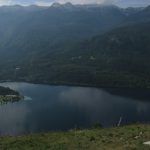
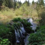
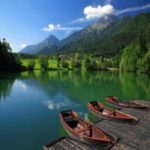
Vogar – View of Lake Bohinj
Slovenija, Gorenjska, Vogar, Bohinjska Bistrica
marker-id-3
https://www.kamnaizlet.com/wp-content/themes/glocal/images/markers/pohodniske-tocke.png
Slovenija, Gorenjska, Vogar, Bohinjska Bistrica
46.1419
15.2244
izletniske-tocke
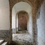
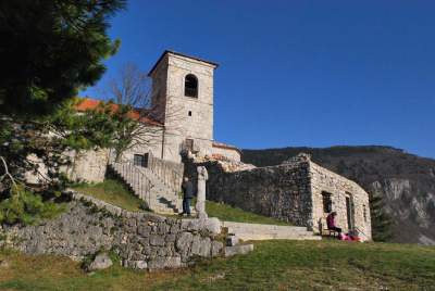
Jurklošter – Ruins of a Cistercian Monastery
Slovenija, Savinjska, Jurklošter 26, Jurklošter
marker-id-4
https://www.kamnaizlet.com/wp-content/themes/glocal/images/markers/izletniske-tocke.png
Slovenija, Savinjska, Jurklošter 26, Jurklošter
45.9211
14.7089
parki
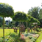
Radensko Polje Landscape Park – Mysterious Intermittent Lakes
Slovenija, Osrednjeslovenska, Radensko polje, Grosuplje
marker-id-5
https://www.kamnaizlet.com/wp-content/themes/glocal/images/markers/parki.png
Slovenija, Osrednjeslovenska, Radensko polje, Grosuplje
44.8666
13.8500
po-sledeh-cloveka-tujina
Pula – Zero Strasse, underground tunnels (Croatia)
Hrvaška, Istra, Pula
marker-id-6
https://www.kamnaizlet.com/wp-content/themes/glocal/images/markers/po-sledeh-cloveka-tujina.png
44.8666
13.8500
muzeji
Pula – Zero Strasse, underground tunnels (Croatia)
Hrvaška, Istra, Pula
marker-id-7
https://www.kamnaizlet.com/wp-content/themes/glocal/images/markers/muzeji.png
44.8512
13.8734
po-sledeh-cloveka-tujina
Monte Madonna – Military Fortifications (Croatia)
Hrvaška, Istra, Monte Madonna
marker-id-8
https://www.kamnaizlet.com/wp-content/themes/glocal/images/markers/po-sledeh-cloveka-tujina.png
Hrvaška, Istra, Monte Madonna
44.8512
13.8734
muzeji
Monte Madonna – Military Fortifications (Croatia)
Hrvaška, Istra, Monte Madonna
marker-id-9
https://www.kamnaizlet.com/wp-content/themes/glocal/images/markers/muzeji.png
Hrvaška, Istra, Monte Madonna
44.8282
13.9167
adrenalinski-izleti
Jangalooz Adventure Park, Pomer (Croatia)
Hrvaška, Istra, Pomer
marker-id-10
https://www.kamnaizlet.com/wp-content/themes/glocal/images/markers/adrenalinski-izleti.png
44.8282
13.9167
po-sledeh-cloveka-tujina
Jangalooz Adventure Park, Pomer (Croatia)
Hrvaška, Istra, Pomer
marker-id-11
https://www.kamnaizlet.com/wp-content/themes/glocal/images/markers/po-sledeh-cloveka-tujina.png
44.7636
13.9217
po-sledeh-narave-tujina
Cape Kamenjak (Croatia)
*Hrvaška, Istra, Premantura
marker-id-12
https://www.kamnaizlet.com/wp-content/themes/glocal/images/markers/po-sledeh-narave-tujina.png
*Hrvaška, Istra, Premantura
44.8485
13.8394
po-sledeh-narave-tujina
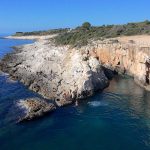
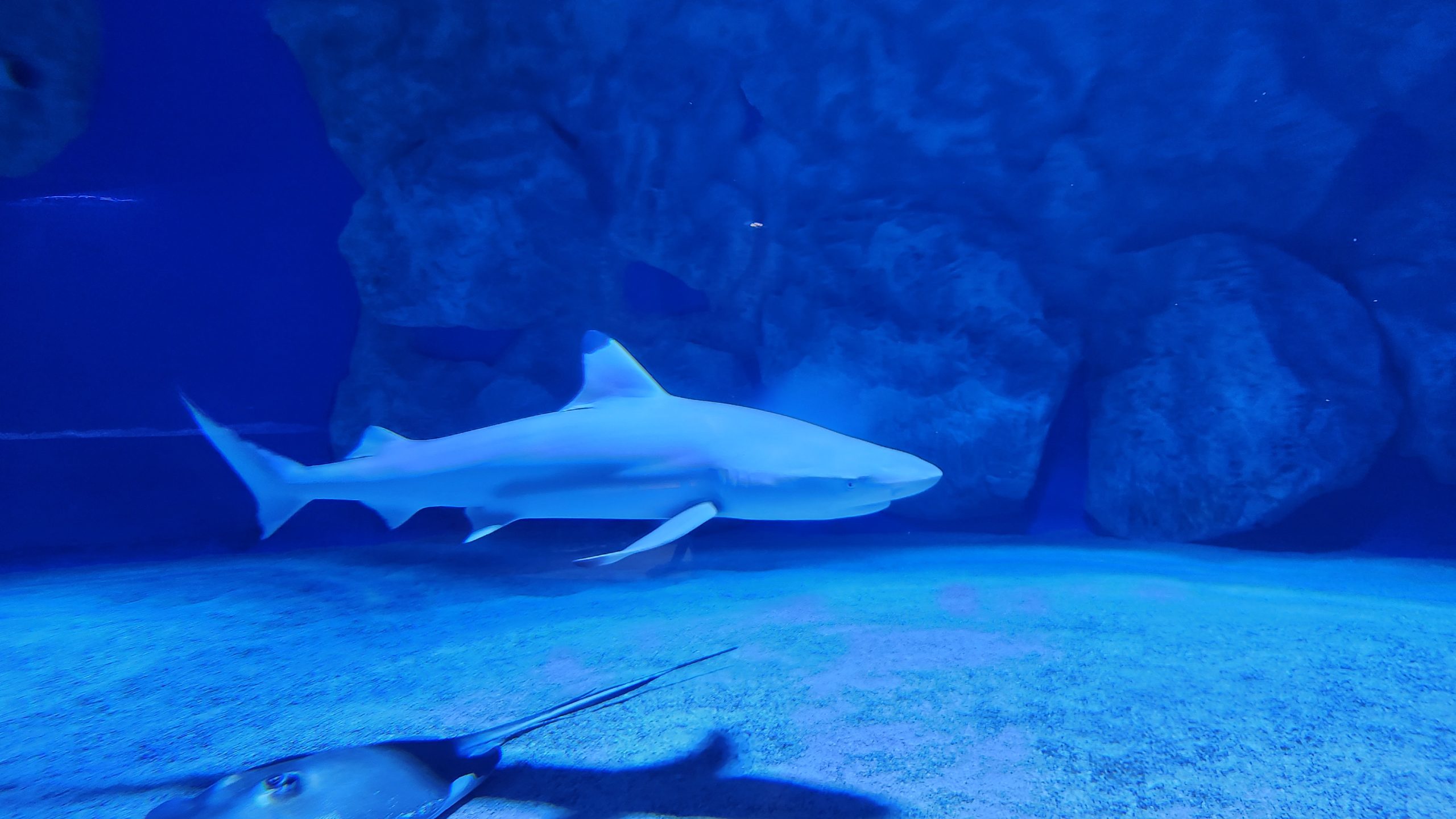
Pula Aquarium (Croatia)
*Hrvaška, Istra, Verudela bb
marker-id-13
https://www.kamnaizlet.com/wp-content/themes/glocal/images/markers/po-sledeh-narave-tujina.png
*Hrvaška, Istra, Verudela bb
44.8485
13.8394
muzeji
Pula Aquarium (Croatia)
*Hrvaška, Istra, Verudela bb
marker-id-14
https://www.kamnaizlet.com/wp-content/themes/glocal/images/markers/muzeji.png
*Hrvaška, Istra, Verudela bb
46.0501911
14.5037666
praznicni-december
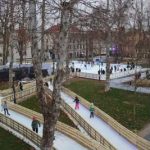
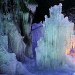
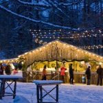
An icy fantasy in the heart of the capital
Slovenija, Osrednje slovenska, Ljubljana, Kongresni trg
marker-id-15
http://www.kamnaizlet.com/wp-content/uploads/2016/11/praznicni-december-green.png
Slovenija, Osrednje slovenska, Ljubljana, Kongresni trg
46.1503156
15.0443189
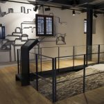
muzeji
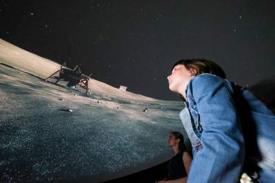
Virtual Mining Museum – 4th DRITL
Slovenija, Štajerska, Delavski dom Trbovlje, Trg svobode 11/a, 1420 Trbovl
marker-id-16
https://www.kamnaizlet.com/wp-content/themes/glocal/images/markers/muzeji.png
Slovenija, Štajerska, Delavski dom Trbovlje, Trg svobode 11/a, 1420 Trbovl
46.146618
15.559883
izletniske-tocke
Odisej Planetarium on Jelenov Ridge
Slovenija, Štajerska, Olimje, Jelenov greben
marker-id-17
https://www.kamnaizlet.com/wp-content/themes/glocal/images/markers/izletniske-tocke.png
Slovenija, Štajerska, Olimje, Jelenov greben
46.146618
15.559883
otroski-koticki
Odisej Planetarium on Jelenov Ridge
Slovenija, Štajerska, Olimje, Jelenov greben
marker-id-18
https://www.kamnaizlet.com/wp-content/themes/glocal/images/markers/otroski-koticki.png
Slovenija, Štajerska, Olimje, Jelenov greben
46.4849533
13.779478400000016
adrenalinski-izleti
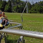
"Besna Pehta" – Summer Sledding
Slovenija, Gorenjska, Rekreacijsko turistični center Žičnice Kranjska Gora, Borovška cesta 103A, 4280 Kranjska Gora
marker-id-19
https://www.kamnaizlet.com/wp-content/themes/glocal/images/markers/adrenalinski-izleti.png
Slovenija, Gorenjska, Rekreacijsko turistični center Žičnice Kranjska Gora, Borovška cesta 103A, 4280 Kranjska Gora
46.48409
13.833396600000015
otroski-koticki
Mišmaš Bakery
Slovenija, Gorenjska, Hotel Rute, Zgornje Rute 40, 4282 Gozd Martuljek
marker-id-20
https://www.kamnaizlet.com/wp-content/themes/glocal/images/markers/otroski-koticki.png
Slovenija, Gorenjska, Hotel Rute, Zgornje Rute 40, 4282 Gozd Martuljek
46.4613825
13.9417362
otroski-koticki
A Walk Through the Fairy Tales of Triglav
Slovenija, Gorenjska, Savska cesta 1, 4281 Mojstrana
marker-id-21
https://www.kamnaizlet.com/wp-content/themes/glocal/images/markers/otroski-koticki.png
Slovenija, Gorenjska, Savska cesta 1, 4281 Mojstrana
46.6094637
14.1446241
po-sledeh-cloveka-tujina
From the Pyramidenkogel tower via the slide (Aut)
*Avstrija, Linden 62, 9074 Vrbsko jezero
marker-id-22
https://www.kamnaizlet.com/wp-content/themes/glocal/images/markers/po-sledeh-cloveka-tujina.png
*Avstrija, Linden 62, 9074 Vrbsko jezero
46.0674444
14.5377568
otroski-koticki
Escape room for kids
Slovenija, Osrednje slovenska, Otroška akademija Izobraževalni center d.o.o. Šmartinska cesta 106 1000 Ljubljana
marker-id-23
https://www.kamnaizlet.com/wp-content/themes/glocal/images/markers/otroski-koticki.png
Slovenija, Osrednje slovenska, Otroška akademija Izobraževalni center d.o.o. Šmartinska cesta 106 1000 Ljubljana
45.8218287
16.0195036
po-sledeh-cloveka-tujina
Zagreb Zoo
*Hrvaška, Zagreb, Zoološki Vrt Grada Zagreb, Maksimirski perivoj bb
marker-id-24
https://www.kamnaizlet.com/wp-content/themes/glocal/images/markers/po-sledeh-cloveka-tujina.png
*Hrvaška, Zagreb, Zoološki Vrt Grada Zagreb, Maksimirski perivoj bb
46.3351538
14.9627139
parki
Mozirski Gaj – Flower Park
Slovenija, Štajerska, Cesta v Savinjski gaj, 3330 Mozirje
marker-id-25
https://www.kamnaizlet.com/wp-content/themes/glocal/images/markers/parki.png
Slovenija, Štajerska, Cesta v Savinjski gaj, 3330 Mozirje
45.528813
13.569403
muzeji
Mediadom Pyrhani – Piran Multimedia Museum
Slovenija, Primorska, Mediadom Pyrhani, Kumarjeva ulica 3, 6330 Piran
marker-id-26
https://www.kamnaizlet.com/wp-content/themes/glocal/images/markers/muzeji.png
Slovenija, Primorska, Mediadom Pyrhani, Kumarjeva ulica 3, 6330 Piran
46.1201555
14.8359269
pohodniske-tocke
The trail around Slivna via Pivkelj Pass
Slovenija, Osrednje slovenska, Družinsko gledališče Kolenc, Vače 12, 1252 Vače
marker-id-27
https://www.kamnaizlet.com/wp-content/themes/glocal/images/markers/pohodniske-tocke.png
Slovenija, Osrednje slovenska, Družinsko gledališče Kolenc, Vače 12, 1252 Vače
46.1201555
14.8359269
pohodniske-tocke
The GEOSS Circular Route
Slovenija, Osrednje slovenska, Družinsko gledališče Kolenc, Vače 12, 1252 Vače
marker-id-28
https://www.kamnaizlet.com/wp-content/themes/glocal/images/markers/pohodniske-tocke.png
Slovenija, Osrednje slovenska, Družinsko gledališče Kolenc, Vače 12, 1252 Vače
45.93864749
14.24252550
toplice-zdravilisca
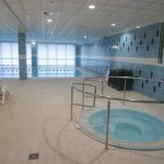
Logatec Swimming Pool
Slovenija, Osrednje slovenska, IOC Zapolje III/5, 1370 Logatec
marker-id-29
https://www.kamnaizlet.com/wp-content/themes/glocal/images/markers/toplice-zdravilisca.png
Slovenija, Osrednje slovenska, IOC Zapolje III/5, 1370 Logatec
45.40076607766131
13.975073231027181
po-sledeh-narave-tujina
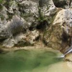
The Trail of Seven Waterfalls – Buzet (Croatia)
*Hrvaška, Buzet, parkirišče ob Istrskem vodovodu
marker-id-30
https://www.kamnaizlet.com/wp-content/themes/glocal/images/markers/po-sledeh-narave-tujina.png
*Hrvaška, Buzet, parkirišče ob Istrskem vodovodu
46.4102614
14.6044186
pohodniske-ture-nad-1200m
The Matkov Kot and Matkov Škaf Hiking Trail
Slovenija, Štajerska, Kmetija Matk
marker-id-31
http://www.kamnaizlet.com/wp-content/themes/glocal/images/icons/pohodniske-tocke-green.png
Slovenija, Štajerska, Kmetija Matk
46.486111
13.992221
pohodniske-ture-nad-1200m
Dovška Baba 1,891 m
Slovenija, Gorenjska, Dovška baba
marker-id-32
http://www.kamnaizlet.com/wp-content/themes/glocal/images/icons/pohodniske-tocke-green.png
Slovenija, Gorenjska, Dovška baba
46.836074
16.030530
pohodniske-ture-pod-1200m
Sotinski Hill 418 m
Slovenija, Prekmurje, Sotinski breg
marker-id-33
http://www.kamnaizlet.com/wp-content/themes/glocal/images/icons/pohodniske-tocke-green.png
Slovenija, Prekmurje, Sotinski breg
46.515
13.861
pohodniske-ture-nad-1200m
Trupejevo Poldne (1,931 m)
Slovenija, Gorenjska, Trupejevo Poldne, Gozd Martuljek
marker-id-34
http://www.kamnaizlet.com/wp-content/themes/glocal/images/icons/pohodniske-tocke-green.png
Slovenija, Gorenjska, Trupejevo Poldne, Gozd Martuljek
46.5061457
14.9708112
kolesarske-poti
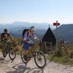
Cycling around Mount Uršlja
Slovenija, Koroška, Ivarčko jezero
marker-id-35
http://www.kamnaizlet.com/wp-content/themes/glocal/images/icons/izletniske-tocke-green.png
Slovenija, Koroška, Ivarčko jezero
46.1799432
14.9440262
pohodniske-ture-pod-1200m
Mountain Hut on Čemšeniška Planina (1,120 m)
Slovenija, Štajerska, Čemšenik
marker-id-36
http://www.kamnaizlet.com/wp-content/themes/glocal/images/icons/pohodniske-tocke-green.png
Slovenija, Štajerska, Čemšenik
46.2264723
15.1004037
jezera
Druškovič Pond
Slovenija, Štajerska, Sv. Lovrenc 79, Prebold
marker-id-37
https://www.kamnaizlet.com/wp-content/themes/glocal/images/markers/jezera.png
Slovenija, Štajerska, Sv. Lovrenc 79, Prebold
46.337816
14.081135
pohodniske-ture-pod-1200m
Babji Zob – 1,128 m
Slovenija, Gorenjska, Kupljenik
marker-id-38
http://www.kamnaizlet.com/wp-content/themes/glocal/images/icons/pohodniske-tocke-green.png
Slovenija, Gorenjska, Kupljenik
46.3483421
14.0593510
slapovi
The Waterfall Below Iglico
Slovenija, Gorenjska, Slap Iglica, Bohinjska Bela
marker-id-39
https://www.kamnaizlet.com/wp-content/themes/glocal/images/markers/slapovi.png
Slovenija, Gorenjska, Slap Iglica, Bohinjska Bela
46.3468302
14.1230636
muzeji
A ride on the museum train along the picturesque Bohinj railway line
Slovenija, Gorenjska, Bohinj
marker-id-40
https://www.kamnaizlet.com/wp-content/themes/glocal/images/markers/muzeji.png
Slovenija, Gorenjska, Bohinj
45.891343
13.901415
naravne-znamenitosti
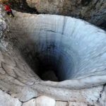
Nature Trail to the Source of the Hubelj River
Slovenija, Primorska, Športni park Pale, Ajdovščina
marker-id-41
https://www.kamnaizlet.com/wp-content/themes/glocal/images/markers/naravne-znamenitosti.png
Slovenija, Primorska, Športni park Pale, Ajdovščina
46.2961339
14.3275455
naravne-znamenitosti
Themed Trails in Udin Boršt
Slovenija, Gorenjska, Udin boršt
marker-id-42
https://www.kamnaizlet.com/wp-content/themes/glocal/images/markers/naravne-znamenitosti.png
Slovenija, Gorenjska, Udin boršt
46.6833333
15.6333333
izletniske-tocke
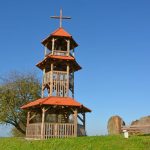
Plački Tower
Slovenija, Štajerska, Plački stolp, Plački Vrh
marker-id-43
https://www.kamnaizlet.com/wp-content/themes/glocal/images/markers/izletniske-tocke.png
Slovenija, Štajerska, Plački stolp, Plački Vrh
46.3610951
15.6785764
jezera
Lake Sestrsko
Slovenija, Štajerska, Medvedce 2322
marker-id-44
https://www.kamnaizlet.com/wp-content/themes/glocal/images/markers/jezera.png
Slovenija, Štajerska, Medvedce 2322
46.0095077
15.6839257
izletniske-tocke
The nesting site of the bee-eater
Slovenija, Štajerska, Župjek
marker-id-45
https://www.kamnaizlet.com/wp-content/themes/glocal/images/markers/izletniske-tocke.png
Slovenija, Štajerska, Župjek
45.7203703
14.7176411
naravne-znamenitosti
The Source of the Ribnica River
Slovenija, Dolenjska, izvir Ribnice
marker-id-46
https://www.kamnaizlet.com/wp-content/themes/glocal/images/markers/naravne-znamenitosti.png
Slovenija, Dolenjska, izvir Ribnice
45.703525
14.223672
jezera
Lake Petelinjsko
Slovenija, Notranjska, Petelinjsko jezero
marker-id-47
https://www.kamnaizlet.com/wp-content/themes/glocal/images/markers/jezera.png
Slovenija, Notranjska, Petelinjsko jezero
45.685467
14.254036
jezera
Lake Palško
Slovenija, Notranjska, Palško jezero
marker-id-48
https://www.kamnaizlet.com/wp-content/themes/glocal/images/markers/jezera.png
Slovenija, Notranjska, Palško jezero
45.9405468
13.7682426
cerkve
Saint Mary above Vitovlje
Slovenija, Severna Primorska, Vitovlje
marker-id-49
https://www.kamnaizlet.com/wp-content/themes/glocal/images/markers/cerkve.png
Slovenija, Severna Primorska, Vitovlje
45.9405468
13.7682426
pohodniske-ture-pod-1200m
Saint Mary above Vitovlje
Slovenija, Severna Primorska, Vitovlje
marker-id-50
http://www.kamnaizlet.com/wp-content/themes/glocal/images/icons/pohodniske-tocke-green.png
Slovenija, Severna Primorska, Vitovlje
46.5735427
16.3801091
naravne-znamenitosti
Polanski Log
Slovenija, Prekmurje, Mala Polana
marker-id-51
https://www.kamnaizlet.com/wp-content/themes/glocal/images/markers/naravne-znamenitosti.png
Slovenija, Prekmurje, Mala Polana
46.6090673
15.1628969
muzeji
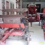
The Blacksmithing, Foundry, and Firefighting Museum in Zgornja Muta
Slovenija, Štajerska, Zgornja Muta
marker-id-52
https://www.kamnaizlet.com/wp-content/themes/glocal/images/markers/muzeji.png
Slovenija, Štajerska, Zgornja Muta
46.3835457
14.6192200
naravne-znamenitosti
The source of the Črna River in the Logarska Valley
Slovenija, Štajerska, Logarska dolina,
marker-id-53
https://www.kamnaizlet.com/wp-content/themes/glocal/images/markers/naravne-znamenitosti.png
Slovenija, Štajerska, Logarska dolina,
46.0538740
15.1387583
naravne-znamenitosti
Gašper's Chestnut
Slovenija, Dolenjska, Radeče - Močilno
marker-id-54
https://www.kamnaizlet.com/wp-content/themes/glocal/images/markers/naravne-znamenitosti.png
Slovenija, Dolenjska, Radeče - Močilno
46.175004
14.008004
slapovi
Tax Waterfalls
Slovenia, Gorenjska, Davški slapovi
marker-id-55
https://www.kamnaizlet.com/wp-content/themes/glocal/images/markers/slapovi.png
Slovenia, Gorenjska, Davški slapovi
46.05039700
13.98670208
izletniske-tocke
Idrija Valleys – Masore
Slovenija, Severna Primorska, Idrijske Krnice
marker-id-56
https://www.kamnaizlet.com/wp-content/themes/glocal/images/markers/izletniske-tocke.png
Slovenija, Severna Primorska, Idrijske Krnice
46.2192084
15.1257831
pohodniske-ture-pod-1200m
Dragov Lodge on Hom – 605 m
Slovenija, Štajerska, Dragov dom na Homu
marker-id-57
http://www.kamnaizlet.com/wp-content/themes/glocal/images/icons/pohodniske-tocke-green.png
Slovenija, Štajerska, Dragov dom na Homu
43.9405483
15.45675419
po-sledeh-cloveka-tujina
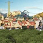
A new amusement park is opening in Croatia – Fun Park Mirnovec
*Hrvaška, Fra Lina Pedisića 4, 23 210 Biograd na Moru
marker-id-58
https://www.kamnaizlet.com/wp-content/themes/glocal/images/markers/po-sledeh-cloveka-tujina.png
*Hrvaška, Fra Lina Pedisića 4, 23 210 Biograd na Moru
46.049616
14.503382
muzeji
Museum of Illusions, Ljubljana
Slovenija, Osrednje slovenska, Kongresni trg 13, Ljubljana
marker-id-59
https://www.kamnaizlet.com/wp-content/themes/glocal/images/markers/muzeji.png
Slovenija, Osrednje slovenska, Kongresni trg 13, Ljubljana
45.8931374
15.6215743
gradovi
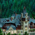
Small Castle – Castles
Slovenija, Štajerska, Topliška cesta 35, 8251 Čatež ob Savi
marker-id-60
https://www.kamnaizlet.com/wp-content/themes/glocal/images/markers/gradovi.png
Slovenija, Štajerska, Topliška cesta 35, 8251 Čatež ob Savi
46.4613010
13.9395386
praznicni-december
Ice Spectacle – Live Nativity Scene in the Ice Kingdom
Slovenija, Gorenjska, Mojstrana
marker-id-61
http://www.kamnaizlet.com/wp-content/uploads/2016/11/praznicni-december-green.png
Slovenija, Gorenjska, Mojstrana
46.063676
14.547980
praznicni-december
Frozen Returns to Ljubljana
Slovenija, Osrednje slovenska, Atlantis, Šmartinska cesta, 1000 Ljubljana
marker-id-62
http://www.kamnaizlet.com/wp-content/uploads/2016/11/praznicni-december-green.png
Slovenija, Osrednje slovenska, Atlantis, Šmartinska cesta, 1000 Ljubljana
46.334506
14.961203
praznicni-december
Slovenia's Christmas Fairy Tale – Mozirski Gaj
Slovenija, Štajerska, Hribernikova 1, 3300 Mozirje
marker-id-63
http://www.kamnaizlet.com/wp-content/uploads/2016/11/praznicni-december-green.png
Slovenija, Štajerska, Hribernikova 1, 3300 Mozirje
46.6080556
14.1452778
praznicni-december
Advent Market at the Pyramidenkogel Tower (Carinthia, Austria)
*Avstrija, stolp Pyramidenkogel, Vrbsko jezero
marker-id-64
http://www.kamnaizlet.com/wp-content/uploads/2016/11/praznicni-december-green.png
*Avstrija, stolp Pyramidenkogel, Vrbsko jezero
46.57912
14.74854
praznicni-december
Christmas Market in Peca (Austrian Carinthia)
*Avstrija, Petzen Bergbahnen GmbH Unterort 52 9143 St. Michael ob Bleiburg
marker-id-65
http://www.kamnaizlet.com/wp-content/uploads/2016/11/praznicni-december-green.png
*Avstrija, Petzen Bergbahnen GmbH Unterort 52 9143 St. Michael ob Bleiburg
46.1781353
14.3233182
praznicni-december
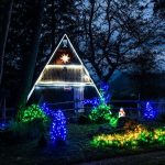
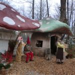
The Fairytale Land of Gorajte
Slovenija, Gorenjska, Gorajte, Virmaše
marker-id-66
http://www.kamnaizlet.com/wp-content/uploads/2016/11/praznicni-december-green.png
Slovenija, Gorenjska, Gorajte, Virmaše
46.433333
14.266666
pohodniske-tocke
Zelenica – 1,536 m
Slovenija, Gorenjska, Zelenica, izhodišče Ljubelj
marker-id-67
https://www.kamnaizlet.com/wp-content/themes/glocal/images/markers/pohodniske-tocke.png
Slovenija, Gorenjska, Zelenica, izhodišče Ljubelj
46.433333
14.266666
pohodniske-ture-nad-1200m
Zelenica – 1,536 m
Slovenija, Gorenjska, Zelenica, izhodišče Ljubelj
marker-id-68
http://www.kamnaizlet.com/wp-content/themes/glocal/images/icons/pohodniske-tocke-green.png
Slovenija, Gorenjska, Zelenica, izhodišče Ljubelj
46.359167
14.601667
pohodniske-ture-nad-1200m
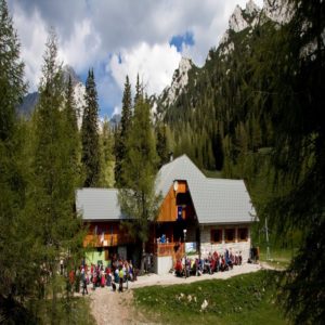
Kamniška Hut on the Kamnik Saddle – 1,864 m
Slovenija, Gorenjska, Kamniško sedlo
marker-id-69
http://www.kamnaizlet.com/wp-content/themes/glocal/images/icons/pohodniske-tocke-green.png
Slovenija, Gorenjska, Kamniško sedlo
46.3028281
14.4269967
jezera
Lake Črnava
Slovenija, Gorenjska, Jezero Črnava, hotel Bor, Preddvor
marker-id-70
https://www.kamnaizlet.com/wp-content/themes/glocal/images/markers/jezera.png
Slovenija, Gorenjska, Jezero Črnava, hotel Bor, Preddvor
46.4246235
14.3352638
pohodniske-ture-nad-1200m
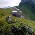
Šija Mountain Hut – 1,523 m
Slovenija, Gorenjska, Taborniški dom Šija, Jelendol 31, Tržič
marker-id-71
http://www.kamnaizlet.com/wp-content/themes/glocal/images/icons/pohodniske-tocke-green.png
Slovenija, Gorenjska, Taborniški dom Šija, Jelendol 31, Tržič
46.2133591
14.5399861
pohodniske-ture-pod-1200m
Komenda Mountain Hut
Slovenija, Gorenjska, Planinski dom Komenda, Podboršt pri Komendi 7g, 1218 Komenda
marker-id-72
http://www.kamnaizlet.com/wp-content/themes/glocal/images/icons/pohodniske-tocke-green.png
Slovenija, Gorenjska, Planinski dom Komenda, Podboršt pri Komendi 7g, 1218 Komenda
46.2133591
14.5399861
otroski-koticki
Komenda Mountain Hut
Slovenija, Gorenjska, Planinski dom Komenda, Podboršt pri Komendi 7g, 1218 Komenda
marker-id-73
https://www.kamnaizlet.com/wp-content/themes/glocal/images/markers/otroski-koticki.png
Slovenija, Gorenjska, Planinski dom Komenda, Podboršt pri Komendi 7g, 1218 Komenda
46.1577020
14.7735852
pohodniske-ture-pod-1200m
Limbarska Mountain – 773 m
Slovenija, Osrednje slovenska, Limbarska gora, Moravče
marker-id-74
http://www.kamnaizlet.com/wp-content/themes/glocal/images/icons/pohodniske-tocke-green.png
Slovenija, Osrednje slovenska, Limbarska gora, Moravče
45.9638393
14.2972634
kolesarske-poti
By bike to the headwaters of the Ljubljanica River and through the mysterious Ljubljana Marshes
Slovenija, Osrednje slovenska, TIC VrhnikaTržaška cesta 9, Vrhnika
marker-id-75
http://www.kamnaizlet.com/wp-content/themes/glocal/images/icons/izletniske-tocke-green.png
Slovenija, Osrednje slovenska, TIC VrhnikaTržaška cesta 9, Vrhnika
45.9638393
14.2972634
izletniske-tocke
By bike to the headwaters of the Ljubljanica River and through the mysterious Ljubljana Marshes
Slovenija, Osrednje slovenska, TIC VrhnikaTržaška cesta 9, Vrhnika
marker-id-76
https://www.kamnaizlet.com/wp-content/themes/glocal/images/markers/izletniske-tocke.png
Slovenija, Osrednje slovenska, TIC VrhnikaTržaška cesta 9, Vrhnika
46.308210
14.700050
izletniske-tocke
The Sawmill
Slovenija, Štajerska, Žagerski mlin, Podvolovljek
marker-id-77
https://www.kamnaizlet.com/wp-content/themes/glocal/images/markers/izletniske-tocke.png
Slovenija, Štajerska, Žagerski mlin, Podvolovljek
46.491092
14.794073
pohodniske-tocke
Peci Mountain Hut – 1,665 m
Slovenija, Koroška, Dom na Peci, Karavanke
marker-id-78
https://www.kamnaizlet.com/wp-content/themes/glocal/images/markers/pohodniske-tocke.png
Slovenija, Koroška, Dom na Peci, Karavanke
46.491092
14.794073
pohodniske-ture-nad-1200m
Peci Mountain Hut – 1,665 m
Slovenija, Koroška, Dom na Peci, Karavanke
marker-id-79
http://www.kamnaizlet.com/wp-content/themes/glocal/images/icons/pohodniske-tocke-green.png
Slovenija, Koroška, Dom na Peci, Karavanke
46.3118535
14.7009611
pohodniske-tocke
Dleskovška Plateau
Slovenija, Štajerska, Podvolovljek, Planina Podvežak
marker-id-80
https://www.kamnaizlet.com/wp-content/themes/glocal/images/markers/pohodniske-tocke.png
Slovenija, Štajerska, Podvolovljek, Planina Podvežak
46.3118535
14.7009611
pohodniske-ture-pod-1200m
Dleskovška Plateau
Slovenija, Štajerska, Podvolovljek, Planina Podvežak
marker-id-81
http://www.kamnaizlet.com/wp-content/themes/glocal/images/icons/pohodniske-tocke-green.png
Slovenija, Štajerska, Podvolovljek, Planina Podvežak
46.5066666
15.1980555
pohodniske-tocke
Grmovšek Hut below Velika Kopa – 1,377 m
Slovenija, Štajerska, Velika Kopa, Pohorje
marker-id-82
https://www.kamnaizlet.com/wp-content/themes/glocal/images/markers/pohodniske-tocke.png
Slovenija, Štajerska, Velika Kopa, Pohorje
46.5066666
15.1980555
pohodniske-ture-nad-1200m
Grmovšek Hut below Velika Kopa – 1,377 m
Slovenija, Štajerska, Velika Kopa, Pohorje
marker-id-83
http://www.kamnaizlet.com/wp-content/themes/glocal/images/icons/pohodniske-tocke-green.png
Slovenija, Štajerska, Velika Kopa, Pohorje
45.962111
14.822279
pohodniske-tocke
Lavrič Hut on Gradišče – 510 m
Slovenija, Dolenjska, Lavričeva koča na Gradišču , Stična
marker-id-84
https://www.kamnaizlet.com/wp-content/themes/glocal/images/markers/pohodniske-tocke.png
Slovenija, Dolenjska, Lavričeva koča na Gradišču , Stična
45.962111
14.822279
pohodniske-ture-pod-1200m
Lavrič Hut on Gradišče – 510 m
Slovenija, Dolenjska, Lavričeva koča na Gradišču , Stična
marker-id-85
http://www.kamnaizlet.com/wp-content/themes/glocal/images/icons/pohodniske-tocke-green.png
Slovenija, Dolenjska, Lavričeva koča na Gradišču , Stična
45.6883333
14.0619444
pohodniske-tocke
Velika Vremščica – 1,027 m
Slovenija, Primorska, Vremščica, od Divače do Pivke
marker-id-86
https://www.kamnaizlet.com/wp-content/themes/glocal/images/markers/pohodniske-tocke.png
Slovenija, Primorska, Vremščica, od Divače do Pivke
45.6883333
14.0619444
pohodniske-ture-pod-1200m
Velika Vremščica – 1,027 m
Slovenija, Primorska, Vremščica, od Divače do Pivke
marker-id-87
http://www.kamnaizlet.com/wp-content/themes/glocal/images/icons/pohodniske-tocke-green.png
Slovenija, Primorska, Vremščica, od Divače do Pivke
45.7561758
13.8320124
izletniske-tocke
Pepin's Karst Garden and the Teran Circular Trail
Slovenija, Primorska, Bunčetova domačija, Dutovlje
marker-id-88
https://www.kamnaizlet.com/wp-content/themes/glocal/images/markers/izletniske-tocke.png
Slovenija, Primorska, Bunčetova domačija, Dutovlje
45.644643
13.899849
pohodniske-tocke
Kokoša Hut – 674 m
Slovenija, Primorska, Koča na Kokoši, pri Lipici
marker-id-89
https://www.kamnaizlet.com/wp-content/themes/glocal/images/markers/pohodniske-tocke.png
Slovenija, Primorska, Koča na Kokoši, pri Lipici
45.644643
13.899849
pohodniske-ture-pod-1200m
Kokoša Hut – 674 m
Slovenija, Primorska, Koča na Kokoši, pri Lipici
marker-id-90
http://www.kamnaizlet.com/wp-content/themes/glocal/images/icons/pohodniske-tocke-green.png
Slovenija, Primorska, Koča na Kokoši, pri Lipici
46.2960303
15.0284567
gradovi
Žovnek Castle and Lake Braslovče
Slovenija, Štajerska, Braslovško jezero pri Polzeli
marker-id-91
https://www.kamnaizlet.com/wp-content/themes/glocal/images/markers/gradovi.png
Slovenija, Štajerska, Braslovško jezero pri Polzeli
46.2960303
15.0284567
jezera
Žovnek Castle and Lake Braslovče
Slovenija, Štajerska, Braslovško jezero pri Polzeli
marker-id-92
https://www.kamnaizlet.com/wp-content/themes/glocal/images/markers/jezera.png
Slovenija, Štajerska, Braslovško jezero pri Polzeli
46.23899
14.07439
pohodniske-tocke
Krek's Hut on Ratitovec – 1,642 m
Slovenija, Gorenjska, Ratitovec, Prtovč
marker-id-93
https://www.kamnaizlet.com/wp-content/themes/glocal/images/markers/pohodniske-tocke.png
Slovenija, Gorenjska, Ratitovec, Prtovč
46.23899
14.07439
pohodniske-ture-nad-1200m
Krek's Hut on Ratitovec – 1,642 m
Slovenija, Gorenjska, Ratitovec, Prtovč
marker-id-94
http://www.kamnaizlet.com/wp-content/themes/glocal/images/icons/pohodniske-tocke-green.png
Slovenija, Gorenjska, Ratitovec, Prtovč
46.1671294
14.3058336
pohodniske-tocke
Lubnik Mountain Hut – 1,025 m
Slovenija, Gorenjska, Koča na Lubniku, Škofja Loka
marker-id-95
https://www.kamnaizlet.com/wp-content/themes/glocal/images/markers/pohodniske-tocke.png
Slovenija, Gorenjska, Koča na Lubniku, Škofja Loka
46.1671294
14.3058336
pohodniske-ture-pod-1200m
Lubnik Mountain Hut – 1,025 m
Slovenija, Gorenjska, Koča na Lubniku, Škofja Loka
marker-id-96
http://www.kamnaizlet.com/wp-content/themes/glocal/images/icons/pohodniske-tocke-green.png
Slovenija, Gorenjska, Koča na Lubniku, Škofja Loka
46.0063791
15.6370564
gradovi
Pišece Castle
Slovenija, Štajerska, Grad Pišece¸, Pišeče
marker-id-97
https://www.kamnaizlet.com/wp-content/themes/glocal/images/markers/gradovi.png
Slovenija, Štajerska, Grad Pišece¸, Pišeče
46.015131
15.692776
izletniske-tocke
Repnice
Slovenija, Štajerska, Repnice, Bizeljsko
marker-id-98
https://www.kamnaizlet.com/wp-content/themes/glocal/images/markers/izletniske-tocke.png
Slovenija, Štajerska, Repnice, Bizeljsko
46.2914564
14.2042992
muzeji
Blacksmithing Museum
Slovenija, Gorenjska, Kovaški muzej, Kropa
marker-id-99
https://www.kamnaizlet.com/wp-content/themes/glocal/images/markers/muzeji.png
Slovenija, Gorenjska, Kovaški muzej, Kropa
46.37614
14.24602
pohodniske-tocke
Dobrča Hut (1,478 m)
Slovenija, Gorenjska, Koča na Dobrči, Zadnja vas
marker-id-100
https://www.kamnaizlet.com/wp-content/themes/glocal/images/markers/pohodniske-tocke.png
Slovenija, Gorenjska, Koča na Dobrči, Zadnja vas
46.37614
14.24602
pohodniske-ture-nad-1200m
Dobrča Hut (1,478 m)
Slovenija, Gorenjska, Koča na Dobrči, Zadnja vas
marker-id-101
http://www.kamnaizlet.com/wp-content/themes/glocal/images/icons/pohodniske-tocke-green.png
Slovenija, Gorenjska, Koča na Dobrči, Zadnja vas
46.3378666
13.5511136
adrenalinski-izleti
Srnica Adventure Park
Slovenija, Gorenjska, Agencija Outdoor Galaxy, Kot 1, Bovec
marker-id-102
https://www.kamnaizlet.com/wp-content/themes/glocal/images/markers/adrenalinski-izleti.png
Slovenija, Gorenjska, Agencija Outdoor Galaxy, Kot 1, Bovec
46.25
14.8166
pohodniske-tocke
Menina Mountain
Slovenija, Gorenjska, Menina planina, pri Tuhinjski dolini
marker-id-103
https://www.kamnaizlet.com/wp-content/themes/glocal/images/markers/pohodniske-tocke.png
Slovenija, Gorenjska, Menina planina, pri Tuhinjski dolini
46.25
14.8166
pohodniske-ture-pod-1200m
Menina Mountain
Slovenija, Gorenjska, Menina planina, pri Tuhinjski dolini
marker-id-104
http://www.kamnaizlet.com/wp-content/themes/glocal/images/icons/pohodniske-tocke-green.png
Slovenija, Gorenjska, Menina planina, pri Tuhinjski dolini
45.676932
13.101050
po-sledeh-cloveka-tujina
Gulliverlandia (Italy)
*Italija, Gulliverlandia, Via San Giuliano 13, 33054 Lignano Sabbiadoro, Italija
marker-id-105
https://www.kamnaizlet.com/wp-content/themes/glocal/images/markers/po-sledeh-cloveka-tujina.png
*Italija, Gulliverlandia, Via San Giuliano 13, 33054 Lignano Sabbiadoro, Italija
46.2342121
15.7027476
muzeji
Rogatec Open-Air Museum
Slovenija, Štajerska, Muzej na prostem Rogatec,Ptujska cesta 23, 3252 Rogatec
marker-id-106
https://www.kamnaizlet.com/wp-content/themes/glocal/images/markers/muzeji.png
Slovenija, Štajerska, Muzej na prostem Rogatec,Ptujska cesta 23, 3252 Rogatec
46.5847279
16.2762351
cerkve
Church of the Holy Trinity – Odranci
Slovenija, Prekmurje, Cerkev Odranci,
Trg Lojzeta Kozarja 1,
9233 Odranci
marker-id-107
https://www.kamnaizlet.com/wp-content/themes/glocal/images/markers/cerkve.png
Slovenija, Prekmurje, Cerkev Odranci,
Trg Lojzeta Kozarja 1,
9233 Odranci
45.8174054
15.3554652
muzeji
Pleterje Open-Air Museum
Slovenija, Dolenjska, Muzej na prostem Pleterje,
Drča 1,
8310 Šentjernej
marker-id-108
https://www.kamnaizlet.com/wp-content/themes/glocal/images/markers/muzeji.png
Slovenija, Dolenjska, Muzej na prostem Pleterje,
Drča 1,
8310 Šentjernej
46.2221964
14.6072967
pohodniske-tocke
High Peak above Kamnik – 660 m
Slovenija, Gorenjska, Visoka špica, Kamnik
marker-id-109
https://www.kamnaizlet.com/wp-content/themes/glocal/images/markers/pohodniske-tocke.png
Slovenija, Gorenjska, Visoka špica, Kamnik
46.2221964
14.6072967
pohodniske-ture-pod-1200m
High Peak above Kamnik – 660 m
Slovenija, Gorenjska, Visoka špica, Kamnik
marker-id-110
http://www.kamnaizlet.com/wp-content/themes/glocal/images/icons/pohodniske-tocke-green.png
Slovenija, Gorenjska, Visoka špica, Kamnik